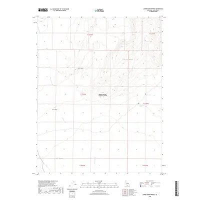
2018 Map of Lower Warm Springs
USGS Topo · Published 2018About this map
Lower Warm Springs and Palm Spring sit as critical water points within this arid expanse of the Mojave Desert. Located inside Death Valley National Park, the landscape is defined by the stark transition from the high elevations of the Saline Range down to the low-lying reaches of the Saline Valley. The drainage patterns of Waucoba Wash illustrate the complex hydraulic movement through the basin, eventually leading toward the prominent sandy features of The Dunes. This modern topographic survey highlights the intersection of extreme elevation changes and the sparse natural springs that have historically dictated travel and survival routes in this portion of Inyo County. The map provides a precise layout of the township and range boundaries that grid this otherwise desolate terrain.
Find a feature on this map
14 named features on this map. Tap any name to fly to it.
Don’t see what you’re looking for? This feature index may not catch every label — zoom into the map to look around manually.
Map Details
Editions of this 2018 Lower Warm Springs Map
This is the sole edition of this map. No revisions or reprints were ever made.
Other maps of this area

1908 · Ballarat
USGS Topo · 1:250,000

1913 · Ballarat
USGS Topo · 1:250,000

1948 · Death Valley
USGS Topo · 1:250,000

1950 · New York Butte
USGS Topo · 1:62,500

1950 · Ubehebe Peak
USGS Topo · 1:62,500

1951 · New York Butte
USGS Topo · 1:62,500

1951 · Ubehebe Peak
USGS Topo · 1:62,500

1951 · Waucoba Wash
USGS Topo · 1:62,500

1954 · Death Valley
USGS Topo · 1:250,000

1956 · Death Valley
USGS Topo · 1:250,000