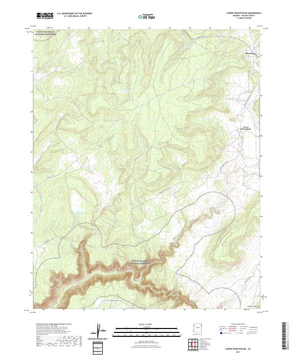
2021 Map of Lower Wheatfields
USGS Topo · Published 2021About this map
Canyon de Chelly National Monument dominates the southwestern corner of this landscape, where the dramatic depths of Canyon de Chelly carve through the high terrain of the Defiance Plateau. This modern survey illustrates the proximity of the Navajo Nation communities of Wheatfields and Lower Wheatfields to these sacred geological formations. The area's water resources are clearly delineated, showing a network of mountain drainages including Wheatfields Cr, Whiskey Cr, and Palisade Cr that descend from the higher elevations. Settlement patterns follow the corridors of Indian Rte 12 and Lower Wheatfields Rd, connecting small residential clusters with critical local water sources like Turkey Reservoir and the uniquely named Black Pinnacle Spring. The map provides a contemporary record of land use where the plateau's surface meets the steep canyon rims.
Find a feature on this map
22 named features on this map. Tap any name to fly to it.
Don’t see what you’re looking for? This feature index may not catch every label — zoom into the map to look around manually.
Map Details
Editions of this 2021 Lower Wheatfields Map
This is the sole edition of this map. No revisions or reprints were ever made.
Other maps of this area

1892 · Canyon De Chelly
USGS Topo · 1:250,000

1954 · Shiprock
USGS Topo · 1:250,000

1955 · Sonsala Butte 4 SE
USGS Topo · 1:24,000

1955 · Sonsala Butte 4 NW
USGS Topo · 1:24,000

1955 · Sonsala Butte 3 SE
USGS Topo · 1:24,000

1955 · Sonsala Butte 1 SE
USGS Topo · 1:24,000

1955 · Sonsala Butte 2 SE
USGS Topo · 1:24,000
1955 · Sonsala Butte 3 NE
USGS Topo · 1:24,000

1955 · Sonsala Butte 1 SW
USGS Topo · 1:24,000
1955 · Sonsala Butte 4 SW
USGS Topo · 1:24,000
Featured Places
- Chinle Agency, AZ
- Fort Defiance Agency
- Lower Wheatfields, Chinle Agency
- Wheatfields, Chinle Agency
- Apache County, AZ