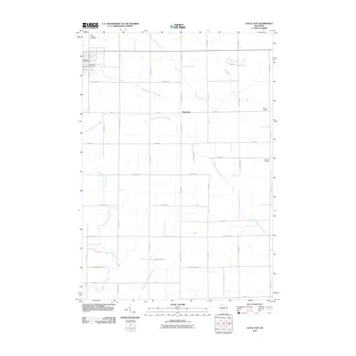
2010 Map of Loyal East
USGS Topo · Published 2010About this map
Dairy-rich Clark County terrain is defined by a grid of rural section roads and the winding headwaters of several regional river systems. The city of Loyal sits at the northwestern edge of this 2010 survey, serving as a hub where Loyal City Cemetery and Saint Anthony Cemetery mark the community's heritage. To the east, the unincorporated settlement of Spokeville occupies the junction of Meridian Ave and 26th Rd, positioned near the upper reaches of the South Branch Yellow River.
Find a feature on this map
35 named features on this map. Tap any name to fly to it.
Don’t see what you’re looking for? This feature index may not catch every label — zoom into the map to look around manually.
Map Details
Editions of this 2010 Loyal East Map
This is the sole edition of this map. No revisions or reprints were ever made.
Other maps of this area

1953 · Neillsville
USGS Topo · 1:62,500

1953 · Abbotsford
USGS Topo · 1:48,000

1953 · Owen
USGS Topo · 1:48,000

1953 · Eau Claire
USGS Topo · 1:250,000

1954 · Granton
USGS Topo · 1:62,500

1958 · Eau Claire
USGS Topo · 1:250,000

1963 · Abbotsford
USGS Topo · 1:62,500

1963 · Owen
USGS Topo · 1:62,500

1964 · Eau Claire
USGS Topo · 1:250,000
1979 · Lindsey
USGS Topo · 1:24,000