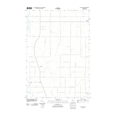
2010 Map of Loyal West
USGS Topo · Published 2010About this map
The Black River forms a winding natural border along the western edge of this Clark County landscape, contrasting with the rigid grid of rural roads and farm plots that define the interior. The settlement of Loyal occupies the northeastern corner, while the smaller community of Christie sits further south along the primary north-south corridor. Local topography is punctuated by the prominent Christie Mound, a distinctive landform rising above the surrounding agricultural fields and the drainages of Cawley Creek and Panther Creek. Genealogists and local historians can locate several established burial grounds, including the East Side Cemetery near the river and the York Center Cemetery in the southeast. The map details an extensive network of named rural routes, such as Willard Rd and Wildwood Rd, reflecting the well-developed dairy and farming infrastructure of central Wisconsin at the beginning of the 21st century.
Find a feature on this map
39 named features on this map. Tap any name to fly to it.
Don’t see what you’re looking for? This feature index may not catch every label — zoom into the map to look around manually.
Map Details
Editions of this 2010 Loyal West Map
This is the sole edition of this map. No revisions or reprints were ever made.
Other maps of this area

1953 · Neillsville
USGS Topo · 1:62,500

1953 · Abbotsford
USGS Topo · 1:48,000

1953 · Owen
USGS Topo · 1:48,000

1953 · Eau Claire
USGS Topo · 1:250,000

1954 · Granton
USGS Topo · 1:62,500

1958 · Eau Claire
USGS Topo · 1:250,000

1963 · Abbotsford
USGS Topo · 1:62,500

1963 · Owen
USGS Topo · 1:62,500

1964 · Eau Claire
USGS Topo · 1:250,000
1979 · Granton
USGS Topo · 1:24,000