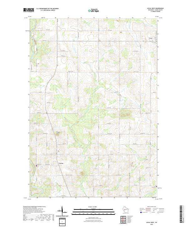
2022 Map of Loyal West
USGS Topo · Published 2022About this map
The Black River forms the primary drainage corridor for this portion of Clark County, winding through a landscape of agricultural tracts and watercourses. Small rural centers such as Loyal and Christie define the local settlement pattern, which is organized around a strictly surveyed grid of county roads and section lines. Notable local topography is centered on Christie Mound, a distinct rise situated just north of the village of Christie. The map preserves the locations of local burial grounds, including the East Side Cem and York Center Cem, which provide valuable anchor points for genealogical research in this dairy-farming region. Numerous smaller streams like Cawley Cr and Panther Cr weave through the township divisions of T26N R2W and T25N R1W, reflecting the well-watered nature of the central Wisconsin plains.
Find a feature on this map
33 named features on this map. Tap any name to fly to it.
Don’t see what you’re looking for? This feature index may not catch every label — zoom into the map to look around manually.
Map Details
Editions of this 2022 Loyal West Map
This is the sole edition of this map. No revisions or reprints were ever made.
Other maps of this area

1953 · Neillsville
USGS Topo · 1:62,500

1953 · Abbotsford
USGS Topo · 1:48,000

1953 · Owen
USGS Topo · 1:48,000

1953 · Eau Claire
USGS Topo · 1:250,000

1954 · Granton
USGS Topo · 1:62,500

1958 · Eau Claire
USGS Topo · 1:250,000

1963 · Abbotsford
USGS Topo · 1:62,500

1963 · Owen
USGS Topo · 1:62,500

1964 · Eau Claire
USGS Topo · 1:250,000
1979 · Granton
USGS Topo · 1:24,000