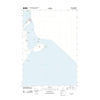
2011 Map of Lubec
USGS Topo · Published 2011About this map
The town of Lubec and its surrounding coastal geography define this easternmost point of the United States. In the early 21st century, the landscape is marked by its critical maritime navigation aids, most notably the West Quoddy Head Light and the Lubec Channel Light. The connection to Canada is established via the Franklin Delano Roosevelt Memorial Bridge, which spans the narrow waters near Lubec Neck and Mowry Point. Beyond the town center, the map details the rugged Atlantic coastline from West Quoddy Head down to Morton Ledge, including hazards and features like Sail Rock, Wormell Ledges, and the Middle Ground. For local historians and genealogists, the Lubec Town Cemetery is a significant landmark situated just west of the main settlement, which transitions into the smaller community of South Lubec along Lubec Rd.
Find a feature on this map
23 named features on this map. Tap any name to fly to it.
Don’t see what you’re looking for? This feature index may not catch every label — zoom into the map to look around manually.
Map Details
Editions of this 2011 Lubec Map
This is the sole edition of this map. No revisions or reprints were ever made.
Other maps of this area

1907 · Eastport
USGS Topo · 1:48,000

1908 · Eastport
USGS Topo · 1:62,500

1917 · Cutler
USGS Topo · 1:62,500

1918 · Cutler
USGS Topo · 1:62,500

1943 · Eastport
USGS Topo · 1:62,500

1945 · Eastport
USGS Topo · 1:62,500

1949 · Eastport
USGS Topo · 1:24,000

1949 · West Lubec
USGS Topo · 1:24,000
1949 · Moose River
USGS Topo · 1:24,000
1949 · Lubec
USGS Topo · 1:24,000