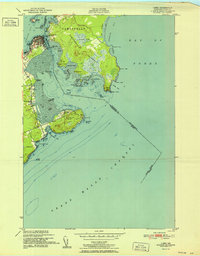
1952 Map of Lubec
USGS Topo · Published 1952About this map
The maritime border between Maine and New Brunswick defines the character of this 1952 survey, centered on the easternmost point of the contiguous United States at West Quoddy Head. This coastal landscape is dominated by the narrow Lubec Channel and the broader waters of the Grand Manan Channel and Bay of Fundy. The settlement of Lubec sits prominently on the neck, serving as a hub for the fishing and canning industries of the era, while across the international boundary lies the sprawling Campobello Island with landmarks like Friar Head and Mulholland Pt.
Find a feature on this map
49 named features on this map. Tap any name to fly to it.
Don’t see what you’re looking for? This feature index may not catch every label — zoom into the map to look around manually.
Map Details
Editions of this 1952 Lubec Map
This is the sole edition of this map. No revisions or reprints were ever made.
Other maps of this area

1907 · Eastport
USGS Topo · 1:48,000

1908 · Eastport
USGS Topo · 1:62,500

1917 · Cutler
USGS Topo · 1:62,500

1918 · Cutler
USGS Topo · 1:62,500

1943 · Eastport
USGS Topo · 1:62,500

1945 · Eastport
USGS Topo · 1:62,500

1949 · Eastport
USGS Topo · 1:24,000

1949 · West Lubec
USGS Topo · 1:24,000
1949 · Moose River
USGS Topo · 1:24,000
1949 · Lubec
USGS Topo · 1:24,000