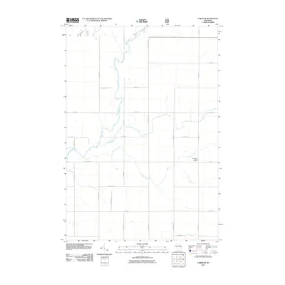
2011 Map of Lublin SE
USGS Topo · Published 2011About this map
The Black River meanders southward through this rural Taylor County landscape, joined by a series of significant tributaries including Pine Creek and Trappers Creek. This section of Wisconsin is defined by a dense grid of local roads, reflecting the organized agricultural and rural residential development of the early 21st century. Notable landmarks include the Saint Marys Catholic Cemetery located near Elm Ave, serving as a vital point of reference for family historians in the area. The map illustrates a transition from the structured township blocks to the natural, winding paths of Syrup Creek and Brick Creek in the south. The convergence of County Hwy-A and numerous local avenues like River Ave and Fairground Ave provides a detailed view of the regional transit network connecting small farms and homesteads.
Find a feature on this map
35 named features on this map. Tap any name to fly to it.
Don’t see what you’re looking for? This feature index may not catch every label — zoom into the map to look around manually.
Map Details
Editions of this 2011 Lublin SE Map
This is the sole edition of this map. No revisions or reprints were ever made.
Other maps of this area

1951 · Lublin
USGS Topo · 1:48,000

1951 · Medford
USGS Topo · 1:48,000

1953 · Abbotsford
USGS Topo · 1:48,000

1953 · Owen
USGS Topo · 1:48,000

1953 · Eau Claire
USGS Topo · 1:250,000

1953 · Rice Lake
USGS Topo · 1:250,000

1958 · Eau Claire
USGS Topo · 1:250,000

1959 · Rice Lake
USGS Topo · 1:250,000

1963 · Abbotsford
USGS Topo · 1:62,500

1963 · Owen
USGS Topo · 1:62,500