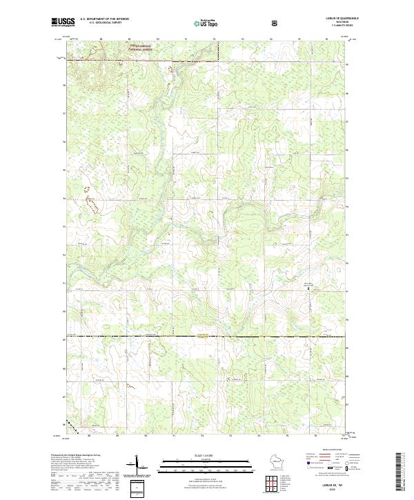
2022 Map of Lublin SE
USGS Topo · Published 2022About this map
Chequamegon National Forest spans the northern reaches of this rural landscape, where dense timber and wetlands meet a grid of named local roads. The terrain is defined by the winding course of the Black River and its tributaries, including Pine Creek and Trappers Cr, which drain the low-lying areas. Cultural markers are concentrated in the southeastern corner, notably the Saint Marys Catholic Cem along Elm Ave. The map also identifies land under the Farm Service Agency Interest of Wisconsin, suggesting areas of managed agricultural preservation or soil conservation. Navigational arteries like Co Hwy A and Co Hwy DD connect remote homesteads, while local names like Bahnke's Ave and Stetson Ave provide specific points of reference for genealogists tracing family land holdings near the boundary between Taylor and Clark counties.
Find a feature on this map
37 named features on this map. Tap any name to fly to it.
Don’t see what you’re looking for? This feature index may not catch every label — zoom into the map to look around manually.
Map Details
Editions of this 2022 Lublin SE Map
This is the sole edition of this map. No revisions or reprints were ever made.
Other maps of this area

1951 · Lublin
USGS Topo · 1:48,000

1951 · Medford
USGS Topo · 1:48,000

1953 · Abbotsford
USGS Topo · 1:48,000

1953 · Owen
USGS Topo · 1:48,000

1953 · Eau Claire
USGS Topo · 1:250,000

1953 · Rice Lake
USGS Topo · 1:250,000

1958 · Eau Claire
USGS Topo · 1:250,000

1959 · Rice Lake
USGS Topo · 1:250,000

1963 · Abbotsford
USGS Topo · 1:62,500

1963 · Owen
USGS Topo · 1:62,500