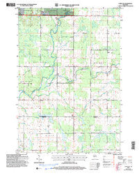
2005 Map of Lublin SE
USGS Topo · Published 2006About this map
The Black River meanders through this portion of north-central Wisconsin, serving as a primary drainage for the surrounding timberlands and marshes. During this era of Forest Service management, the northern reaches of the quadrangle are protected within the Chequamegon Nicolet National Forest. The landscape is a mosaic of agricultural township boundaries, including Maplehurst, Holway, Hixon, and Hoard, where rural life is anchored by civic and religious landmarks. A concentration of community history is visible near the eastern boundary, featuring St Marys Ch and an adjacent Cem. Educational history is preserved at the site of Poplar Grove Sch, while the local Townhall marks the political center of the township. Industrial activity is primarily limited to resource extraction, evidenced by several Gravel Pits distributed along the river valleys and tributary streams like Pine Creek and Trappers Creek.
Find a feature on this map
17 named features on this map. Tap any name to fly to it.
Don’t see what you’re looking for? This feature index may not catch every label — zoom into the map to look around manually.
Map Details
Editions of this 2005 Lublin SE Map
This is the sole edition of this map. No revisions or reprints were ever made.
Other maps of this area

1951 · Lublin
USGS Topo · 1:48,000

1951 · Medford
USGS Topo · 1:48,000

1953 · Abbotsford
USGS Topo · 1:48,000

1953 · Owen
USGS Topo · 1:48,000

1953 · Eau Claire
USGS Topo · 1:250,000

1953 · Rice Lake
USGS Topo · 1:250,000

1958 · Eau Claire
USGS Topo · 1:250,000

1959 · Rice Lake
USGS Topo · 1:250,000

1963 · Abbotsford
USGS Topo · 1:62,500

1963 · Owen
USGS Topo · 1:62,500