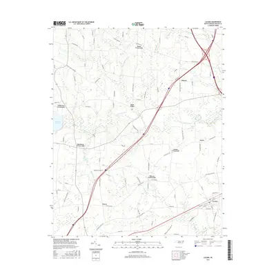
2016 Map of Lucama
USGS Topo · Published 2016About this map
Lucama anchors the southeastern corner of this Wilson County landscape, where the flat coastal plain is intricately carved by the drainage networks of Contentnea Creek and Black Cr. This 2016 survey highlights a persistent pattern of rural development centered on historic junctions, including Stotts Crossroads, Wilkerson Crossroads, and Buckhorn Crossroads. These nodes often developed around early agriculture and local commerce, serving as landmarks for generations of North Carolina families. To the west, the Buckhorn Reservoir and Hinnants Lake suggest the critical role of water management in this low-lying area, while the meandering paths of Marsh Swamp and Lee Swamp define the natural boundaries between farms. The presence of Rock Ridge and smaller settlements like Fillmore and Scotts provides a clear view of the area's modern road system superimposed over traditional settlement patterns, making it a valuable resource for tracing property lines and family landholdings.
Find a feature on this map
87 named features on this map. Tap any name to fly to it.
Don’t see what you’re looking for? This feature index may not catch every label — zoom into the map to look around manually.
Map Details
Editions of this 2016 Lucama Map
This is the sole edition of this map. No revisions or reprints were ever made.
Other maps of this area

1902 · Kenly
USGS Topo · 1:62,500

1902 · Rocky Mount
USGS Topo · 1:62,500

1902 · Spring Hope
USGS Topo · 1:62,500

1903 · Kenly
USGS Topo · 1:62,500

1904 · Rocky Mount
USGS Topo · 1:62,500

1904 · Springhope
USGS Topo · 1:62,500

1904 · Wilson
USGS Topo · 1:62,500

1953 · Rocky Mount
USGS Topo · 1:250,000

1953 · Raleigh
USGS Topo · 1:250,000

1954 · Rocky Mount
USGS Topo · 1:250,000