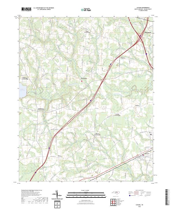
2022 Map of Lucama
USGS Topo · Published 2022About this map
Lucama and its surrounding rural communities are the focus of this modern survey of Wilson County, North Carolina. The landscape is defined by the winding course of Contentnea Creek, which feeds into the Buckhorn Reservoir in the western section of the quadrangle. This area remains characterized by its numerous historic road junctions, such as Stotts Crossroads, Lamms Crossroads, and Moores Crossroads, reflecting a settlement pattern built around agricultural transit and local commerce.
Find a feature on this map
90 named features on this map. Tap any name to fly to it.
Don’t see what you’re looking for? This feature index may not catch every label — zoom into the map to look around manually.
Map Details
Editions of this 2022 Lucama Map
This is the sole edition of this map. No revisions or reprints were ever made.
Other maps of this area

1902 · Kenly
USGS Topo · 1:62,500

1902 · Rocky Mount
USGS Topo · 1:62,500

1902 · Spring Hope
USGS Topo · 1:62,500

1903 · Kenly
USGS Topo · 1:62,500

1904 · Rocky Mount
USGS Topo · 1:62,500

1904 · Springhope
USGS Topo · 1:62,500

1904 · Wilson
USGS Topo · 1:62,500

1953 · Rocky Mount
USGS Topo · 1:250,000

1953 · Raleigh
USGS Topo · 1:250,000

1954 · Rocky Mount
USGS Topo · 1:250,000