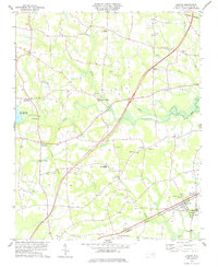
1978 Map of Lucama
USGS Topo · Published 1978About this map
Contentnea Creek and its various tributaries, including Marsh Swamp and Little Swamp, define the rural landscape of this coastal plain region in the late 1970s. The town of Lucama serves as a primary hub along the Seaboard Coast Line railroad, while numerous crossroads communities like Rock Ridge, Buckhorn Crossroads, and Stotts Crossroads punctuate the agricultural land. This map reveals a high density of country churches and family burial grounds, providing a significant resource for genealogists researching the Wilson County area. Landmarks such as Nobles Chapel, Little Rock Ch, and the Springfield Sch illustrate the community structure of the era. The western edge is dominated by the Buckhorn Reservoir, where a Gaging Sta monitors the flow of water through this network of branches and creeks.
Find a feature on this map
45 named features on this map. Tap any name to fly to it.
Don’t see what you’re looking for? This feature index may not catch every label — zoom into the map to look around manually.
Map Details
Editions of this 1978 Lucama Map
This is the sole edition of this map. No revisions or reprints were ever made.
Other maps of this area

1902 · Kenly
USGS Topo · 1:62,500

1902 · Rocky Mount
USGS Topo · 1:62,500

1902 · Spring Hope
USGS Topo · 1:62,500

1903 · Kenly
USGS Topo · 1:62,500

1904 · Rocky Mount
USGS Topo · 1:62,500

1904 · Springhope
USGS Topo · 1:62,500

1904 · Wilson
USGS Topo · 1:62,500

1953 · Rocky Mount
USGS Topo · 1:250,000

1953 · Raleigh
USGS Topo · 1:250,000

1954 · Rocky Mount
USGS Topo · 1:250,000