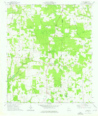
1974 Map of Lucile
USGS Topo · Published 1976About this map
The boundary between Early and Miller County defines this pocket of southwest Georgia, where the land is partitioned into a pattern of agriculture and wooded lowlands. Small community centers like Lucile and Jones Crossroads serve as the primary navigational anchors for a landscape threaded by water. The drainage of Susan Ford Creek and Flat Creek flows through the northern reaches, while the southwest corner is marked by the presence of Howards Mill and its associated Howards Mill Creek.
Find a feature on this map
29 named features on this map. Tap any name to fly to it.
Don’t see what you’re looking for? This feature index may not catch every label — zoom into the map to look around manually.
Map Details
Editions of this 1974 Lucile Map
2 editions found
Other maps of this area

1953 · Dothan
USGS Topo · 1:250,000

1954 · Dothan
USGS Topo · 1:250,000

1955 · Dothan
USGS Topo · 1:250,000

1970 · Gordon
USGS Topo · 1:24,000
1970 · Saffold
USGS Topo · 1:24,000

1970 · Columbia
USGS Topo · 1:24,000

1973 · Blakely South
USGS Topo · 1:24,000

1973 · Hentown
USGS Topo · 1:24,000

1974 · Donalsonville NE
USGS Topo · 1:24,000
1974 · Donalsonville East
USGS Topo · 1:24,000