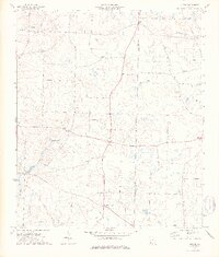
1974 Map of Lucile
USGS Topo · Published 1976About this map
Lucile and Jones Crossroads anchor this rural landscape along the Early County and Miller County line in Southwest Georgia during the mid-1970s. The area is defined by a dense network of country churches that served established agricultural communities, including Allens Chapel, Mt Hosea Ch, and Springfield Ch. Small settlements such as Killarney and Mayhaw are interconnected by a system of light-duty and unimproved roads, reflecting a landscape still deeply rooted in its farming heritage.
Find a feature on this map
21 named features on this map. Tap any name to fly to it.
Don’t see what you’re looking for? This feature index may not catch every label — zoom into the map to look around manually.
Map Details
Editions of this 1974 Lucile Map
2 editions found
Other maps of this area

1953 · Dothan
USGS Topo · 1:250,000

1954 · Dothan
USGS Topo · 1:250,000

1955 · Dothan
USGS Topo · 1:250,000

1970 · Gordon
USGS Topo · 1:24,000
1970 · Saffold
USGS Topo · 1:24,000

1970 · Columbia
USGS Topo · 1:24,000

1973 · Blakely South
USGS Topo · 1:24,000

1973 · Hentown
USGS Topo · 1:24,000

1974 · Donalsonville NE
USGS Topo · 1:24,000
1974 · Donalsonville East
USGS Topo · 1:24,000