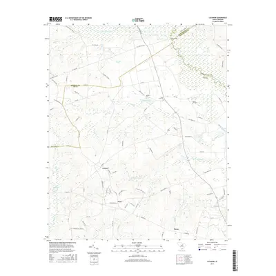
2017 Map of Lucknow
USGS Topo · Published 2017About this map
Lucknow serves as the central focal point of this 2017 study of the rural Lowcountry borderlands, where the Little Lynches River and Lynches River converge amidst a network of historic roadways. The landscape is defined by its watercourses and small agricultural settlements like Zemp and Thursa, reflecting a traditional South Carolina pattern of dispersed homesteads and community centers. Historically significant routes such as Old Stagecoach Rd and Old Wire Rd suggest the era of early overland travel and communication through this region.
Find a feature on this map
81 named features on this map. Tap any name to fly to it.
Don’t see what you’re looking for? This feature index may not catch every label — zoom into the map to look around manually.
Map Details
Editions of this 2017 Lucknow Map
This is the sole edition of this map. No revisions or reprints were ever made.
Other maps of this area

1941 · Spartanburg
USGS Topo · 1:250,000

1953 · Spartanburg
USGS Topo · 1:250,000

1957 · Ashwood
USGS Topo · 1:62,500

1960 · Spartanburg
USGS Topo · 1:250,000

1963 · Spartanburg
USGS Topo · 1:250,000

1964 · Spartanburg
USGS Topo · 1:250,000
1968 · Lake Robinson
USGS Topo · 1:24,000

1968 · Kellytown
USGS Topo · 1:24,000
1969 · Bishopville East
USGS Topo · 1:24,000
1970 · Cassatt
USGS Topo · 1:24,000