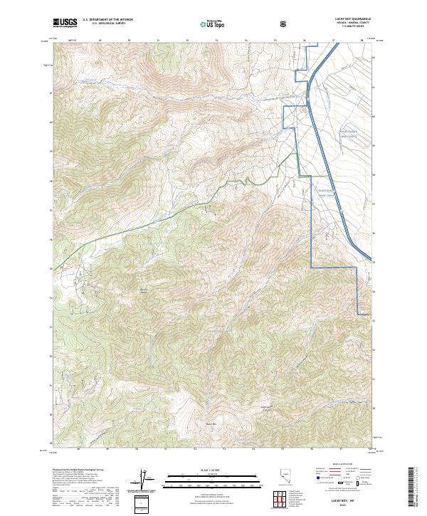
2023 Map of Lucky Boy
USGS Topo · Published 2023About this map
The eastern slopes of the Wassuk Range define this high-desert terrain southwest of Hawthorne, where the industrial footprint of the Hawthorne Army Depot meets the protected lands of the Toiyabe National Forest. The landscape is a complex network of steep drainages, including Cottonwood Canyon and Stone Cabin Canyon, which descend toward the basin floor. This modern survey illustrates the persistent importance of water sources in the arid Great Basin, marking locations like Buller Spring and Rock Cabin Spring. Transportation routes through the heights are represented by Lucky Boy Pass Rd and the Garfield Trl, providing access across the rugged peaks near Buller Mtn. The map clearly delineates the transition from military-managed territory to public forest lands, documenting the modern management of this Mineral County wilderness.
Find a feature on this map
29 named features on this map. Tap any name to fly to it.
Don’t see what you’re looking for? This feature index may not catch every label — zoom into the map to look around manually.
Map Details
Editions of this 2023 Lucky Boy Map
This is the sole edition of this map. No revisions or reprints were ever made.
Other maps of this area

1909 · Hawthorne
USGS Topo · 1:250,000

1911 · Hawthorne
USGS Topo · 1:250,000

1915 · Hawthorne
USGS Topo · 1:250,000

1948 · Walker Lake
USGS Topo · 1:250,000

1955 · Powell Mtn
USGS Topo · 1:62,500

1955 · Hawthorne
USGS Topo · 1:62,500

1956 · Mt. Grant
USGS Topo · 1:62,500

1956 · Aurora
USGS Topo · 1:62,500

1957 · Walker Lake
USGS Topo · 1:250,000

1962 · Walker Lake
USGS Topo · 1:250,000