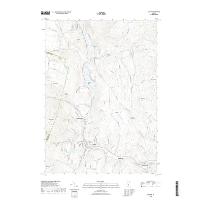
2018 Map of Ludlow
USGS Topo · Published 2018About this map
Ludlow serves as a central hub in this Vermont valley where the Black River winds southward through a landscape defined by significant peaks and reservoirs. The village of Proctorsville and the settlement of Grahamsville anchor the eastern and central regions, illustrating the historical development of small industrial and residential pockets along the river's course. Notable water bodies such as Amherst Lake, Echo Lake, and Lake Rescue form a chain of glacial lakes to the north, while the Jewell Brook watershed has been modified with the Jewell Brook Site Number 3 and Number 5 Reservoirs. Local family history is preserved in numerous burial grounds, including the Tyson-Pollard Cem, Plymouth Kingdom Cem, and Twentymile Stream Cem. The terrain rises sharply to the west into the Green Mountains, marked by landmarks like Ludlow Mtn and Sawyer Rocks, which overlook the deep valley floor.
Find a feature on this map
71 named features on this map. Tap any name to fly to it.
Don’t see what you’re looking for? This feature index may not catch every label — zoom into the map to look around manually.
Map Details
Editions of this 2018 Ludlow Map
This is the sole edition of this map. No revisions or reprints were ever made.
Other maps of this area

1891 · Rutland
USGS Topo · 1:62,500

1893 · Wallingford
USGS Topo · 1:62,500

1893 · Rutland
USGS Topo · 1:62,500

1911 · Woodstock
USGS Topo · 1:62,500

1913 · Woodstock
USGS Topo · 1:62,500

1928 · Ludlow
USGS Topo · 1:48,000

1929 · Ludlow
USGS Topo · 1:62,500

1932 · Ludlow
USGS Topo · 1:62,500

1943 · Woodstock
USGS Topo · 1:62,500

1950 · Glens Falls
USGS Topo · 1:250,000