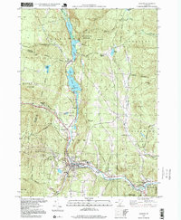
1997 Map of Ludlow
USGS Topo · Published 1999About this map
The Black River corridor serves as the primary artery through this Vermont landscape, connecting a string of alpine lakes and historic settlements. Flowing south from Amherst Lake, Echo Lake, and Lake Rescue, the river passes through the village of Ludlow, where the Black River High Sch and the Armory are central landmarks. The map illustrates the region's late-20th-century character, balancing its industrial roots seen at the Quarry and various Gravel Pit sites with its growth as a recreational destination. This is most evident in the development of the Okemo Mountain Ski Area on the slopes of Okemo Mountain and the preservation of land within Camp Plymouth State Park and the Okemo State Forest. Smaller, potentially vanished hamlets like Plymouth Kingdom and Grahamville suggest earlier patterns of mountain settlement that contrast with the more established hubs of Proctorsville and Smithville.
Find a feature on this map
54 named features on this map. Tap any name to fly to it.
Don’t see what you’re looking for? This feature index may not catch every label — zoom into the map to look around manually.
Map Details
Editions of this 1997 Ludlow Map
This is the sole edition of this map. No revisions or reprints were ever made.
Other maps of this area

1891 · Rutland
USGS Topo · 1:62,500

1893 · Wallingford
USGS Topo · 1:62,500

1893 · Rutland
USGS Topo · 1:62,500

1911 · Woodstock
USGS Topo · 1:62,500

1913 · Woodstock
USGS Topo · 1:62,500

1928 · Ludlow
USGS Topo · 1:48,000

1929 · Ludlow
USGS Topo · 1:62,500

1932 · Ludlow
USGS Topo · 1:62,500

1943 · Woodstock
USGS Topo · 1:62,500

1950 · Glens Falls
USGS Topo · 1:250,000