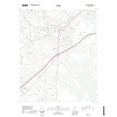
2020 Map of Lugoff
USGS Topo · Published 2020About this map
The Wateree River defines the eastern boundary of this South Carolina landscape, creating a broad wetland corridor where Betty Neck Swamp and English Swamp meet the river's edge. The settlement of Lugoff sits at the center of a dense road network, reflecting its role as a local hub near the historic city of Camden just across the water. The terrain is a mix of small drainages and managed water bodies, including Stokes Pond and Fredricksburg Pond, interspersed with creeks such as Twentytwo Mile Cr and Gillies Cr. Local genealogy and community markers are preserved in labels like Saint Pauls Cem and family-named roads like Boulware Rd, while the Over the Hill Airport occupies a prominent clearing southwest of the main township.
Find a feature on this map
94 named features on this map. Tap any name to fly to it.
Don’t see what you’re looking for? This feature index may not catch every label — zoom into the map to look around manually.
Map Details
Editions of this 2020 Lugoff Map
This is the sole edition of this map. No revisions or reprints were ever made.
Other maps of this area

1935 · Camden
USGS Topo · 1:48,000

1935 · Killian
USGS Topo · 1:48,000

1937 · Killian
USGS Topo · 1:62,500

1938 · Camden
USGS Topo · 1:62,500

1938 · Hagood
USGS Topo · 1:62,500

1941 · Spartanburg
USGS Topo · 1:250,000

1942 · Camden
USGS Topo · 1:125,000

1953 · Camden South
USGS Topo · 1:24,000

1953 · Messers Pond
USGS Topo · 1:24,000

1953 · Lugoff
USGS Topo · 1:24,000