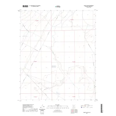
2023 Map of Lumley Lake NW
USGS Topo · Published 2023About this map
White Sands Missile Range dominates this arid Sierra County landscape, where restrictive military boundaries overlay the natural drainages of the Tularosa Basin. The terrain is defined by the winding course of Salt Creek, which flows through the center of the sheet, joined by seasonal waters from Sweetwater Creek and Good Fortune Creek. This survey captures the specialized infrastructure of the range, documenting an extensive network of numbered security and access roads, such as WSMR P Route 7 and WSMR S Route 299, that crisscross the high desert. The absence of civilian settlements reflects the area's long-standing use for defense testing, while the underlying Public Land Survey System grid reveals the original township and range divisions that preceded military acquisition.
Find a feature on this map
16 named features on this map. Tap any name to fly to it.
Don’t see what you’re looking for? This feature index may not catch every label — zoom into the map to look around manually.
Map Details
Editions of this 2023 Lumley Lake NW Map
This is the sole edition of this map. No revisions or reprints were ever made.
Other maps of this area

1916 · Salinas Peak
USGS Topo · 1:125,000

1916 · Tularosa
USGS Topo · 1:125,000

1947 · Capitol Peak
USGS Topo · 1:62,500

1948 · Black Top Mountain
USGS Topo · 1:62,500

1948 · Salinas Peak
USGS Topo · 1:62,500

1948 · Lumley Lake
USGS Topo · 1:62,500

1954 · Tularosa
USGS Topo · 1:250,000

1958 · Tularosa
USGS Topo · 1:250,000
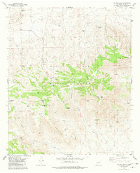
1981 · Salinas Peak
USGS Topo · 1:24,000

1981 · Tularosa
USGS Topo · 1:100,000