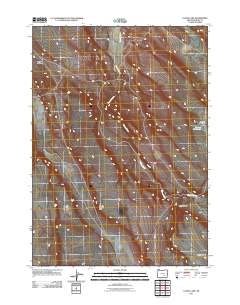
2011 Map of Lunch Lake
USGS Topo · Published 2011About this map
Buzzard Creek flows through this high desert region of Harney County, following a winding course that defines the drainage patterns of the area. The landscape is characterized by its distinct seasonal water features and geological formations, such as the Smoky Hollow Rim and the descent into Deep Canyon. This 2011 survey illustrates a sparse network of unpaved roads and trails that traverse the terrain, primarily providing access to water bodies like Chicken Feed Lake and Buzzard Lake. The map reveals a place shaped by its hydrology and relief, where named features like Smoky Hollow indicate the unique character of the basins found between the rimrock. It is an essential document for understanding the modern topographic state of this undeveloped corner of the Oregon desert.
Find a feature on this map
7 named features on this map. Tap any name to fly to it.
Don’t see what you’re looking for? This feature index may not catch every label — zoom into the map to look around manually.
Map Details
Editions of this 2011 Lunch Lake Map
This is the sole edition of this map. No revisions or reprints were ever made.
Other maps of this area

1955 · Burns
USGS Topo · 1:250,000

1958 · Burns
USGS Topo · 1:250,000

1959 · Burns
USGS Topo · 1:250,000
1980 · Hughet Spring
USGS Topo · 1:24,000
1980 · Meadow Lake
USGS Topo · 1:24,000
1980 · Lunch Lake
USGS Topo · 1:24,000
1980 · Flybee Lake
USGS Topo · 1:24,000
1980 · Iron Mtn. Flat
USGS Topo · 1:24,000
1980 · Stinking Lake
USGS Topo · 1:24,000
1980 · Lake on The Trail
USGS Topo · 1:24,000