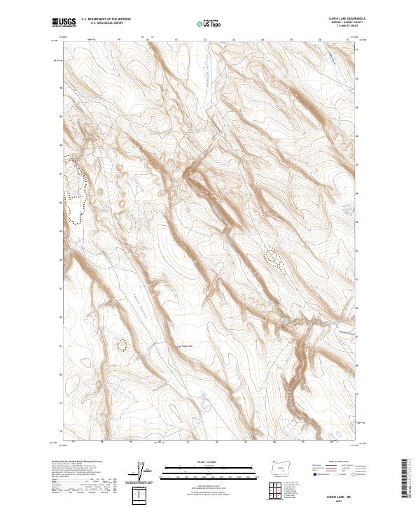
2023 Map of Lunch Lake
USGS Topo · Published 2023About this map
The high desert terrain of Harney County is defined here by a series of dramatic volcanic drainages and seasonal water features. Smoky Hollow Rim and its namesake Smoky Hollow dominate the western portion of the quadrangle, illustrating the complex topographic shifts characteristic of the Oregon outback. The seasonal hydrology of the region is anchored by Chicken Feed Lake in the east and the winding course of Buzzard Creek. Erosion has carved distinct landmarks into the landscape, notably the intersecting paths of Buzzard Canyon, Deep Canyon, and Angle Canyon. These features indicate a rugged environment where water, though scarce, has been the primary architect of the land's form, creating isolated plateaus and deep, shaded draws.
Find a feature on this map
11 named features on this map. Tap any name to fly to it.
Don’t see what you’re looking for? This feature index may not catch every label — zoom into the map to look around manually.
Map Details
Editions of this 2023 Lunch Lake Map
This is the sole edition of this map. No revisions or reprints were ever made.
Other maps of this area

1955 · Burns
USGS Topo · 1:250,000

1958 · Burns
USGS Topo · 1:250,000

1959 · Burns
USGS Topo · 1:250,000
1980 · Hughet Spring
USGS Topo · 1:24,000
1980 · Meadow Lake
USGS Topo · 1:24,000

1980 · Lunch Lake
USGS Topo · 1:24,000
1980 · Flybee Lake
USGS Topo · 1:24,000

1980 · Iron Mtn. Flat
USGS Topo · 1:24,000

1980 · Stinking Lake
USGS Topo · 1:24,000

1980 · Lake on The Trail
USGS Topo · 1:24,000