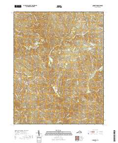
2019 Map of Lunenburg
USGS Topo · Published 2019About this map
The Lunenburg County Courthouse serves as the focal point for this section of Southside Virginia, anchoring the small community of Lunenburg. The landscape is defined by the dendritic drainage patterns of the North Meherrin River and the Middle Meherrin River, which carve through the Piedmont terrain alongside numerous tributaries like Lyle Cr and Reedy Creek. This modern survey illustrates a rural infrastructure centered on historically named junctions and crossroad settlements such as Rehoboth, Loves Mill, and Wattsboro.
Find a feature on this map
52 named features on this map. Tap any name to fly to it.
Don’t see what you’re looking for? This feature index may not catch every label — zoom into the map to look around manually.
Map Details
Editions of this 2019 Lunenburg Map
This is the sole edition of this map. No revisions or reprints were ever made.
Other maps of this area

1891 · Farmville
USGS Topo · 1:125,000

1893 · Farmville
USGS Topo · 1:125,000

1947 · Roanoke
USGS Topo · 1:250,000

1953 · Greensboro
USGS Topo · 1:250,000

1954 · Greensboro
USGS Topo · 1:250,000

1955 · Chase City
USGS Topo · 1:62,500

1955 · Kenbridge
USGS Topo · 1:62,500

1958 · Crewe
USGS Topo · 1:62,500

1958 · Keysville
USGS Topo · 1:62,500

1959 · Roanoke
USGS Topo · 1:250,000