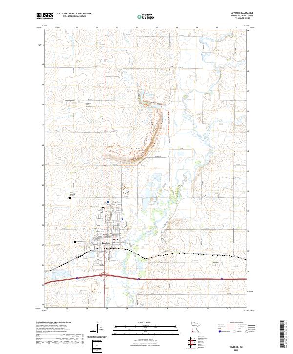
2022 Map of Luverne
USGS Topo · Published 2022About this map
The town of Luverne serves as the focal point of this southwestern Minnesota landscape, situated at the edge of the prominent Coteau des Prairies plateau. The local topography is dominated by The Mound, a significant elevation feature north of the city that is circumscribed by a complex network of paths, including the Lower Cliffline Trl, Upper Cliffline Trl, and the Western Loop Trl. This area is shaped by the southward flow of the Rock River, which is fed by tributaries such as Mound Cr and Champepadan Cr.
Find a feature on this map
65 named features on this map. Tap any name to fly to it.
Don’t see what you’re looking for? This feature index may not catch every label — zoom into the map to look around manually.
Map Details
Editions of this 2022 Luverne Map
This is the sole edition of this map. No revisions or reprints were ever made.
Other maps of this area

1955 · Sioux Falls
USGS Topo · 1:250,000

1958 · Sioux Falls
USGS Topo · 1:250,000

1967 · Edgerton South
USGS Topo · 1:24,000

1967 · Magnolia
USGS Topo · 1:24,000

1967 · Hills
USGS Topo · 1:24,000

1967 · Kenneth
USGS Topo · 1:24,000

1967 · Jasper SE
USGS Topo · 1:24,000

1967 · Hills NE
USGS Topo · 1:24,000

1967 · Ellsworth
USGS Topo · 1:24,000

1967 · Ash Creek
USGS Topo · 1:24,000