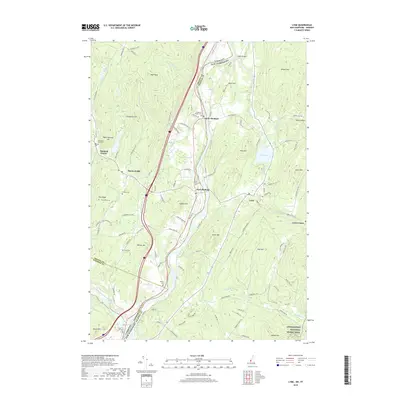
2018 Map of Lyme
USGS Topo · Published 2018About this map
The Connecticut River serves as the primary artery and state boundary dividing the Vermont and New Hampshire landscapes documented here. On the Vermont side, the topography is defined by significant elevations such as High Peak and Houghton Hill, with settlements clustered at Thetford Center and Thetford Hill. This area is particularly rich in family and community history, evidenced by a high density of burial grounds including Evergreen Rest Cem, Pleasant Ridge Cem, and The Glebe Cem. Crossing the river at the Edgell Bridge, the terrain rises into the hills of Grafton County, New Hampshire, where Lyme and Lyme Center anchor the local geography. The map traces the winding paths of Grant Brook and Hewes Brook as they descend from peaks like Moose Mtn and Plot Hill, illustrating a typical New England pattern of upland farms and valley-bottom communities.
Find a feature on this map
113 named features on this map. Tap any name to fly to it.
Don’t see what you’re looking for? This feature index may not catch every label — zoom into the map to look around manually.
Map Details
Editions of this 2018 Lyme Map
This is the sole edition of this map. No revisions or reprints were ever made.
Other maps of this area

1896 · Strafford
USGS Topo · 1:62,500

1906 · Hanover
USGS Topo · 1:62,500

1908 · Hanover
USGS Topo · 1:62,500

1927 · Mascoma
USGS Topo · 1:62,500

1931 · Mt. Cube
USGS Topo · 1:62,500

1932 · Mascoma
USGS Topo · 1:62,500

1933 · Mt. Cube
USGS Topo · 1:62,500

1944 · Strafford
USGS Topo · 1:62,500

1950 · Glens Falls
USGS Topo · 1:250,000

1956 · Glens Falls
USGS Topo · 1:250,000