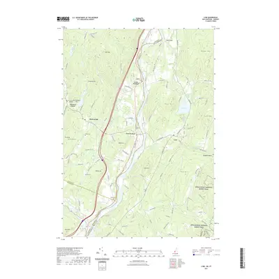
2021 Map of Lyme
USGS Topo · Published 2021About this map
The Connecticut River serves as the dividing line between New Hampshire and Vermont in this detailed survey of the Upper Valley region. The map highlights a series of small, historic settlements including Lyme and Lyme Center on the eastern bank, while Thetford Center, Thetford Hill, and North Thetford populate the western side. The area is defined by numerous family-named landmarks and high elevations like Moose Mtn, High Peak, and Blood Mtn.
Find a feature on this map
112 named features on this map. Tap any name to fly to it.
Don’t see what you’re looking for? This feature index may not catch every label — zoom into the map to look around manually.
Map Details
Editions of this 2021 Lyme Map
This is the sole edition of this map. No revisions or reprints were ever made.
Other maps of this area

1896 · Strafford
USGS Topo · 1:62,500

1906 · Hanover
USGS Topo · 1:62,500

1908 · Hanover
USGS Topo · 1:62,500

1927 · Mascoma
USGS Topo · 1:62,500

1931 · Mt. Cube
USGS Topo · 1:62,500

1932 · Mascoma
USGS Topo · 1:62,500

1933 · Mt. Cube
USGS Topo · 1:62,500

1944 · Strafford
USGS Topo · 1:62,500

1950 · Glens Falls
USGS Topo · 1:250,000

1956 · Glens Falls
USGS Topo · 1:250,000