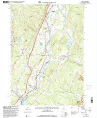
1996 Map of Lyme
USGS Topo · Published 2001About this map
The Connecticut River serves as the central artery for this Upper Valley landscape, dividing the settlements of Lyme and East Thetford along the New Hampshire and Vermont border. In the late twentieth century, the area maintained a distinct educational and social character, anchored by the historic Thetford Academy and the Barnes Sch. The terrain is defined by prominent peaks like High Peak and Ely Mountain, while local infrastructure includes a Covered Bridge and a Drive-in Theater near the northern boundary. Transportation and community life follow the river's path, with clusters at Thetford Hill and Pompanoosuc at the confluence with the Ompompanoosuc River. Genealogists can find several burial grounds, including Highland Cemetery and the Wilmot Cem, situated near Wilmot Mountain.
Find a feature on this map
65 named features on this map. Tap any name to fly to it.
Don’t see what you’re looking for? This feature index may not catch every label — zoom into the map to look around manually.
Map Details
Editions of this 1996 Lyme Map
This is the sole edition of this map. No revisions or reprints were ever made.
Other maps of this area

1896 · Strafford
USGS Topo · 1:62,500

1906 · Hanover
USGS Topo · 1:62,500

1908 · Hanover
USGS Topo · 1:62,500

1927 · Mascoma
USGS Topo · 1:62,500

1931 · Mt. Cube
USGS Topo · 1:62,500

1932 · Mascoma
USGS Topo · 1:62,500

1933 · Mt. Cube
USGS Topo · 1:62,500

1944 · Strafford
USGS Topo · 1:62,500

1950 · Glens Falls
USGS Topo · 1:250,000

1956 · Glens Falls
USGS Topo · 1:250,000