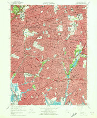
1969 Map of Lynbrook
USGS Topo · Published 1972About this map
Belmont Park and its famous Belmont Park Race Track anchor the dense suburban landscape of western Long Island during the late 1960s. This survey detail captures the intricate street grids and burgeoning infrastructure of the Queens Nassau border, where massive institutional footprints like Creedmoor State Hospital sit alongside established residential villages. The map reveals a community heavily defined by its transportation corridors, with the Long Island railroad lines and the Southern State Parkway threading through towns like Floral Park and Valley Stream.
Find a feature on this map
146 named features on this map. Tap any name to fly to it.
Don’t see what you’re looking for? This feature index may not catch every label — zoom into the map to look around manually.
Map Details
Editions of this 1969 Lynbrook Map
2 editions found
Other maps of this area

1889 · Brooklyn
USGS Topo · 1:62,500

1891 · Brooklyn
USGS Topo · 1:62,500

1891 · Harlem
USGS Topo · 1:62,500

1897 · Harlem
USGS Topo · 1:62,500

1897 · Brooklyn
USGS Topo · 1:62,500

1897 · Hempstead
USGS Topo · 1:62,500

1897 · Oyster Bay
USGS Topo · 1:62,500

1898 · Harlem
USGS Topo · 1:62,500

1898 · Hempstead
USGS Topo · 1:62,500

1898 · Brooklyn
USGS Topo · 1:62,500