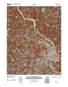
2011 Map of Lynchburg
USGS Topo · Published 2011About this map
The James River snakes through the heart of this central Virginia landscape, defining the industrial and civic layout of Lynchburg and its surrounding communities. The city's steep geography is reflected in the numerous named hills like Court House Hill, Federal Hill, and Diamond Hill, where the Jefferson Street Tunnel and Monument Terrace mark the urban center's complex verticality. Along the river, a series of infrastructure projects including the Reusens Dam and Scots Mill Dam indicate a long history of water power and management, while several islands such as Treasure Island and Percivals Island sit at the city's doorstep.
Find a feature on this map
128 named features on this map. Tap any name to fly to it.
Don’t see what you’re looking for? This feature index may not catch every label — zoom into the map to look around manually.
Map Details
Editions of this 2011 Lynchburg Map
This is the sole edition of this map. No revisions or reprints were ever made.
Other maps of this area

1892 · Lynchburg
USGS Topo · 1:125,000

1894 · Lexington
USGS Topo · 1:125,000

1935 · Buena Vista
USGS Topo · 1:48,000

1935 · Amherst
USGS Topo · 1:48,000

1939 · Amherst
USGS Topo · 1:62,500

1939 · Buena Vista
USGS Topo · 1:62,500

1940 · Buena Vista
USGS Topo · 1:62,500

1944 · Lynchburg
USGS Topo · 1:62,500

1947 · Roanoke
USGS Topo · 1:250,000

1950 · Goode
USGS Topo · 1:62,500