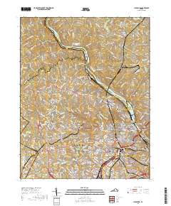
2019 Map of Lynchburg
USGS Topo · Published 2019About this map
The James River winds through the heart of this Central Virginia landscape, carving a deep valley that defines the industrial and academic character of Lynchburg. By the early 21st century, the city’s complex geography is marked by historic institutions like Randolph College, Lynchburg College, and the Virginia University of Lynchburg. The river's path is punctuated by several islands, including Woodruff Island and Percivals Island, while the urban core is anchored by the Lynchburg Courthouse and the engineered Jefferson Street Tunnel. Significant residential growth is evident in neighborhoods such as Rivermont, Fairview Heights, and West Lynchburg, which are linked by the CSX railroad and major spans like the Carter Glass Bridge. The map preserves the locations of numerous historic burial grounds, from the Old City Cemetery to the Fort Hill Memorial Park Cemetery, offering a detailed record of the city's civic and genealogical footprint.
Find a feature on this map
291 named features on this map. Tap any name to fly to it.
Don’t see what you’re looking for? This feature index may not catch every label — zoom into the map to look around manually.
Map Details
Editions of this 2019 Lynchburg Map
This is the sole edition of this map. No revisions or reprints were ever made.
Other maps of this area

1892 · Lynchburg
USGS Topo · 1:125,000

1894 · Lexington
USGS Topo · 1:125,000

1935 · Buena Vista
USGS Topo · 1:48,000

1935 · Amherst
USGS Topo · 1:48,000

1939 · Amherst
USGS Topo · 1:62,500

1939 · Buena Vista
USGS Topo · 1:62,500

1940 · Buena Vista
USGS Topo · 1:62,500

1944 · Lynchburg
USGS Topo · 1:62,500

1947 · Roanoke
USGS Topo · 1:250,000

1950 · Goode
USGS Topo · 1:62,500