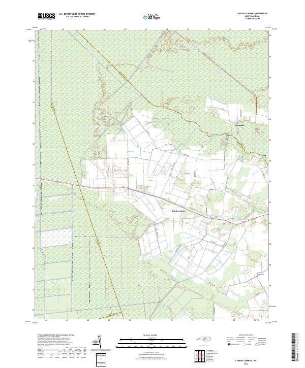
2022 Map of Lynchs Corner
USGS Topo · Published 2022About this map
The Great Dismal Swamp dominates the northern reaches of this landscape, where a sophisticated network of historical water management features like County Line Ditch and Bull Boulevard Ditch define the marshy terrain. These man-made channels intersect the dense wetlands, illustrating a long history of drainage efforts in the region. The map captures the boundary lines where Camden, Pasquotank, Gates, and Perquimans counties converge amidst the wetlands and timbered tracts.
Find a feature on this map
36 named features on this map. Tap any name to fly to it.
Don’t see what you’re looking for? This feature index may not catch every label — zoom into the map to look around manually.
Map Details
Editions of this 2022 Lynchs Corner Map
This is the sole edition of this map. No revisions or reprints were ever made.
Other maps of this area

1906 · Beckford
USGS Topo · 1:48,000

1907 · Beckford
USGS Topo · 1:62,500

1919 · Suffolk
USGS Topo · 1:62,500

1940 · Beckford
USGS Topo · 1:62,500

1940 · Lake Drummond
USGS Topo · 1:62,500

1940 · South Mills
USGS Topo · 1:62,500

1945 · Lake Drummond
USGS Topo · 1:62,500

1952 · South Mills
USGS Topo · 1:62,500

1953 · Norfolk
USGS Topo · 1:250,000

1954 · Corapeake
USGS Topo · 1:24,000