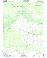
1997 Map of Lynchs Corner
USGS Topo · Published 2000About this map
The Great Dismal Swamp National Wildlife Refuge dominates the northern reaches of this landscape at the turn of the millennium. The survey illustrates a complex network of man-made alterations designed to manage the swampy terrain, including the prominent Bull Boulevard and an Old Railroad Grade cutting through the dense vegetation. Along the southern edges of the swamp, the small community of Lynchs Corner serves as a focal point for the surrounding rural area, where the Pasquotank River begins to snake through the lowlands. Local landmarks such as Ramoth Gilead Ch and Mt Carmel Ch indicate the established social centers of this Pasquotank County region. The map provides a look at the borderlands between North Carolina's developed farmland and the protected wilderness of Dismal Swamp State Park, capturing the unique hydrology of the Drainage Canal system.
Find a feature on this map
19 named features on this map. Tap any name to fly to it.
Don’t see what you’re looking for? This feature index may not catch every label — zoom into the map to look around manually.
Map Details
Editions of this 1997 Lynchs Corner Map
This is the sole edition of this map. No revisions or reprints were ever made.
Other maps of this area

1906 · Beckford
USGS Topo · 1:48,000

1907 · Beckford
USGS Topo · 1:62,500

1919 · Suffolk
USGS Topo · 1:62,500

1940 · Beckford
USGS Topo · 1:62,500

1940 · Lake Drummond
USGS Topo · 1:62,500

1940 · South Mills
USGS Topo · 1:62,500

1945 · Lake Drummond
USGS Topo · 1:62,500

1952 · South Mills
USGS Topo · 1:62,500

1953 · Norfolk
USGS Topo · 1:250,000

1954 · Corapeake
USGS Topo · 1:24,000