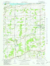
1979 Map of Lyndonville
USGS Topo · Published 1980About this map
The Lake Ontario shoreline near Thirty-mile Pt dominates the northern edge of this late 1970s survey, marking a transition from the vast waters of the Great Lakes to the productive orchard lands of Orleans Co and Niagara Co. This rural landscape is anchored by the village of Lyndonville, where the winding course of Johnson Creek meets localized development. The interior is defined by a dense grid of farm-to-market roads such as Haight Road and Orchard Road, supporting a series of crossroads settlements including Millers, Yates Center, and West Ridgeway. Local history is preserved in several rural landmarks, from St Patricks Ch and Somerset Cem to the lighthouse at the lake's edge. The presence of multiple cemeteries, like North Ridgeway Cem and Daniels Cem, provides specific points of interest for genealogists tracing families in the townships of Somerset, Yates, and Ridgeway.
Find a feature on this map
50 named features on this map. Tap any name to fly to it.
Don’t see what you’re looking for? This feature index may not catch every label — zoom into the map to look around manually.
Map Details
Editions of this 1979 Lyndonville Map
This is the sole edition of this map. No revisions or reprints were ever made.
Other maps of this area

1897 · Olcott
USGS Topo · 1:62,500

1897 · Medina
USGS Topo · 1:62,500

1897 · Lockport
USGS Topo · 1:62,500

1897 · Ridgeway
USGS Topo · 1:62,500

1899 · Niagara
USGS Topo · 1:125,000

1902 · Lockport
USGS Topo · 1:62,500

1905 · Lockport
USGS Topo · 1:62,500

1944 · Ashwood
USGS Topo · 1:31,680

1948 · Lockport
USGS Topo · 1:62,500

1948 · Olcott
USGS Topo · 1:62,500