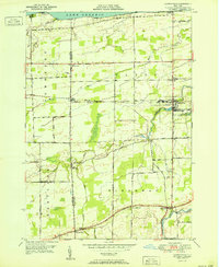
1951 Map of Lyndonville
USGS Topo · Published 1951About this map
Lake Ontario defines the northern reaches of this landscape, where Thirtymile Pt overlooks a shoreline carved by Golden Hill Creek and Marsh Creek. The inland area reflects a mid-century agricultural character, organized by a precise grid of roads like Hall Road and Town Line Road. The New York Central railroad serves as the primary industrial artery, passing directly through the hub of Lyndonville and the smaller settlement of Millers.
Find a feature on this map
45 named features on this map. Tap any name to fly to it.
Don’t see what you’re looking for? This feature index may not catch every label — zoom into the map to look around manually.
Map Details
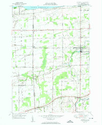
Editions of this 1951 Lyndonville Map
2 editions found
Other maps of this area

1897 · Olcott
USGS Topo · 1:62,500

1897 · Medina
USGS Topo · 1:62,500

1897 · Lockport
USGS Topo · 1:62,500

1897 · Ridgeway
USGS Topo · 1:62,500

1899 · Niagara
USGS Topo · 1:125,000

1902 · Lockport
USGS Topo · 1:62,500

1905 · Lockport
USGS Topo · 1:62,500

1944 · Ashwood
USGS Topo · 1:31,680

1948 · Lockport
USGS Topo · 1:62,500

1948 · Olcott
USGS Topo · 1:62,500