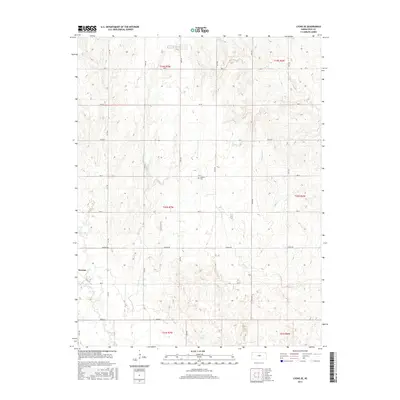
2015 Map of Lyons SE
USGS Topo · Published 2015About this map
Saxman anchors the southwestern portion of this Rice County landscape, serving as a primary point of reference in an area defined by a grid of rural section roads and meandering prairie waterways. The terrain is marked by the drainage patterns of several tributaries, including the eastward-flowing Dry Cr and Sand Cr, which eventually converge toward the lower elevations of the Cow Cr basin. This 2015 survey illustrates a landscape of agricultural utility, where the spatial organization of the land remains deeply tied to the original Public Land Survey System township and range lines.
Find a feature on this map
28 named features on this map. Tap any name to fly to it.
Don’t see what you’re looking for? This feature index may not catch every label — zoom into the map to look around manually.
Map Details
Editions of this 2015 Lyons SE Map
This is the sole edition of this map. No revisions or reprints were ever made.
Other maps of this area

1891 · Hutchinson
USGS Topo · 1:125,000

1893 · Hutchinson
USGS Topo · 1:125,000

1894 · Lyons
USGS Topo · 1:125,000

1955 · Great Bend
USGS Topo · 1:250,000

1955 · Hutchinson
USGS Topo · 1:250,000

1957 · Great Bend
USGS Topo · 1:250,000

1958 · Great Bend
USGS Topo · 1:250,000

1959 · Hutchinson
USGS Topo · 1:250,000

1964 · Windom SW
USGS Topo · 1:24,000
1965 · Hutchinson NW
USGS Topo · 1:24,000