
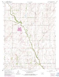
1964 Map of Windom SW
USGS Topo · Published 1966About this map
The Little Arkansas River meanders diagonally across this rural landscape, serving as a primary drainage for the surrounding prairie. In the mid-1960s, the area was divided into distinct townships including Rockville, Hayes, and East Washington, where the pattern of sections and section-line roads defined the local geography. Small community hubs are anchored by local institutions such as Rockville Sch and the nearby Rockville Cem, while further east, the Andover Ch and Andover Cem stand along the banks of Lone Tree Creek. Industrial activity is visible in several locations, notably a Quarry situated near the river's bend and a Gravel Pit to the south. These features, along with the Prairie Vista Sch, illustrate the infrastructure of a distributed agricultural society during the mid-twentieth century.
Find a feature on this map
23 named features on this map. Tap any name to fly to it.
Don’t see what you’re looking for? This feature index may not catch every label — zoom into the map to look around manually.
Map Details
Editions of this 1964 Windom SW Map
2 editions found
Other maps of this area

1891 · Hutchinson
USGS Topo · 1:125,000

1893 · Hutchinson
USGS Topo · 1:125,000

1894 · Lyons
USGS Topo · 1:125,000

1955 · Great Bend
USGS Topo · 1:250,000

1955 · Hutchinson
USGS Topo · 1:250,000

1957 · Great Bend
USGS Topo · 1:250,000

1958 · Great Bend
USGS Topo · 1:250,000

1959 · Hutchinson
USGS Topo · 1:250,000

1964 · Conway
USGS Topo · 1:24,000
1965 · Hutchinson NW
USGS Topo · 1:24,000