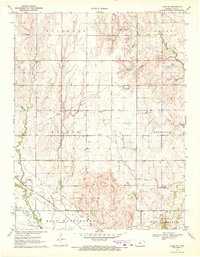
1970 Map of Lyons SE
USGS Topo · Published 1972About this map
Saxman sits at the convergence of heavy transport and agricultural drainage in this 1970 snapshot of Rice County. The southern portion of the landscape is dominated by industrial energy extraction, most notably the Welch Bornholdt Oil Field and the Wherry Field, indicating the region's reliance on petroleum during this era. A major Pipeline network cuts across the terrain, reflecting the mid-century infrastructure required to move resources from these fields.
Find a feature on this map
17 named features on this map. Tap any name to fly to it.
Don’t see what you’re looking for? This feature index may not catch every label — zoom into the map to look around manually.
Map Details
Editions of this 1970 Lyons SE Map
This is the sole edition of this map. No revisions or reprints were ever made.
Other maps of this area

1891 · Hutchinson
USGS Topo · 1:125,000

1893 · Hutchinson
USGS Topo · 1:125,000

1894 · Lyons
USGS Topo · 1:125,000

1955 · Great Bend
USGS Topo · 1:250,000

1955 · Hutchinson
USGS Topo · 1:250,000

1957 · Great Bend
USGS Topo · 1:250,000

1958 · Great Bend
USGS Topo · 1:250,000

1959 · Hutchinson
USGS Topo · 1:250,000

1964 · Windom SW
USGS Topo · 1:24,000
1965 · Hutchinson NW
USGS Topo · 1:24,000