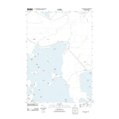
2011 Map of Machias Bay
USGS Topo · Published 2011About this map
Holmes Bay and Machias Bay dominate this coastal landscape, where the jagged Maine shoreline is punctuated by numerous islands, ledges, and protective necks. The settlement of North Cutler sits near the eastern edge, connected by a network of local roads such as Ridge Rd and Cackley Rd. This area reveals the historical importance of the sea and the highlands, with prominent elevations like Woodruff Mountain and Pettegrove Mountain providing vantage points over the water. Inland, the terrain softens into a series of freshwater bodies including Gardner Lake and Holmes Pond. Genealogists and local historians can find the Look Cemetery situated near the northern reaches of the bay, while aviation interests are represented by Ramsdell Field. From the tidal reaches of Randall Point Flats to the rocky outcrops of Avery Rock and Colbeth Rock, the map documents a maritime environment where every point and ledge has been named by generations of sailors and residents.
Find a feature on this map
56 named features on this map. Tap any name to fly to it.
Don’t see what you’re looking for? This feature index may not catch every label — zoom into the map to look around manually.
Map Details
Editions of this 2011 Machias Bay Map
This is the sole edition of this map. No revisions or reprints were ever made.
Other maps of this area

1907 · Eastport
USGS Topo · 1:48,000

1908 · Eastport
USGS Topo · 1:62,500

1917 · Cutler
USGS Topo · 1:62,500

1918 · Machias
USGS Topo · 1:62,500

1918 · Cutler
USGS Topo · 1:62,500

1941 · Machias
USGS Topo · 1:62,500

1941 · Gardner Lake
USGS Topo · 1:62,500

1943 · Gardner Lake
USGS Topo · 1:62,500

1943 · Eastport
USGS Topo · 1:62,500

1945 · Eastport
USGS Topo · 1:62,500