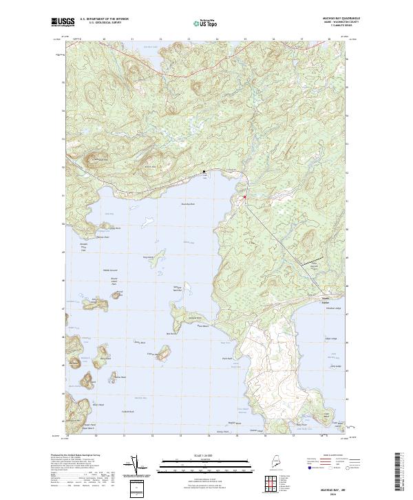
2024 Map of Machias Bay
USGS Topo · Published 2024About this map
Machias Bay defines this Downeast Maine landscape, where the jagged Atlantic coastline meets a complex network of islands and inlets. At North Cutler and the sheltered waters of Bucks Harbor, the map illustrates a maritime economy shaped by the local topography. The interior features significant elevations like Woodruff Mtn and Pettegrow Mtn, while the coastline is marked by geological points of interest such as Jasper Beach and the expansive Sprague Neck. Historical and community landmarks are preserved on the sheet, including the Mary Look Cem along Cutler Rd and the Cutler Regional Airport. Much of the southern archipelago is protected within the Cross Island National Wildlife Refuge, encompassing Cross Island Narrows and the surrounding rocky outcrops that have long dictated navigation in these northern waters.
Find a feature on this map
71 named features on this map. Tap any name to fly to it.
Don’t see what you’re looking for? This feature index may not catch every label — zoom into the map to look around manually.
Map Details
Editions of this 2024 Machias Bay Map
This is the sole edition of this map. No revisions or reprints were ever made.
Other maps of this area

1907 · Eastport
USGS Topo · 1:48,000

1908 · Eastport
USGS Topo · 1:62,500

1917 · Cutler
USGS Topo · 1:62,500

1918 · Machias
USGS Topo · 1:62,500

1918 · Cutler
USGS Topo · 1:62,500

1941 · Machias
USGS Topo · 1:62,500

1941 · Gardner Lake
USGS Topo · 1:62,500

1943 · Gardner Lake
USGS Topo · 1:62,500

1943 · Eastport
USGS Topo · 1:62,500

1945 · Eastport
USGS Topo · 1:62,500