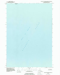
1993 Map of Machias Seal Island South
USGS Topo · Published 1995About this map
Machias Seal Island sits at the northern edge of this maritime study, which focuses primarily on the open waters of the Atlantic Ocean and the Gulf of Maine. Based on imagery from 1990 and field-checked in the early 1990s, the map highlights the isolated nature of this marine environment. A significant geopolitical note in the margin indicates that a portion of the United States-Canadian boundary in this area was in dispute at the time of publication and is therefore not shown. The entire area depicted lies below 20 feet in elevation, emphasizing the sheet's focus on the sea and its immediate coastal features rather than terrestrial settlements or infrastructure.
Find a feature on this map
4 named features on this map. Tap any name to fly to it.
Don’t see what you’re looking for? This feature index may not catch every label — zoom into the map to look around manually.
Map Details
Editions of this 1993 Machias Seal Island South Map
This is the sole edition of this map. No revisions or reprints were ever made.
Other maps of this area

1917 · Cutler
USGS Topo · 1:62,500

1918 · Cutler
USGS Topo · 1:62,500

1961 · Eastport
USGS Topo · 1:250,000
1969 · Eastport
USGS Topo · 1:250,000
1976 · Eastport
USGS Topo · 1:250,000
1985 · Machias
USGS Topo · 1:100,000
1986 · Eastport
USGS Topo · 1:100,000
1986 · Petit Manan Point
USGS Topo · 1:100,000
1993 · Machias Seal Island
USGS Topo · 1:24,000
1993 · Old Man
USGS Topo · 1:24,000