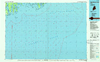
1986 Map of Petit Manan Point
USGS Topo · Published 1986About this map
Petit Manan Point and the complex archipelago of Downeast Maine define this mid-1980s planimetric study. The map documents a deeply indented coastline where the Gulf of Maine meets several interconnected bays, including Narraguagus Bay and Pleasant Bay. This coastal region is characterized by significant landforms like Gouldsboro Neck and Pigeon Hill, which rise above a network of sheltered harbors and coves.
Find a feature on this map
117 named features on this map. Tap any name to fly to it.
Don’t see what you’re looking for? This feature index may not catch every label — zoom into the map to look around manually.
Map Details
Editions of this 1986 Petit Manan Point Map
2 editions found
Other maps of this area

1902 · Cherryfield
USGS Topo · 1:62,500

1904 · Cherryfield
USGS Topo · 1:62,500

1904 · Bar Harbor
USGS Topo · 1:62,500

1904 · Petit Manan
USGS Topo · 1:62,500

1917 · Cutler
USGS Topo · 1:62,500

1918 · Machias
USGS Topo · 1:62,500

1918 · Cutler
USGS Topo · 1:62,500

1921 · Great Wass Island
USGS Topo · 1:62,500

1921 · Columbia Falls
USGS Topo · 1:62,500

1930 · Tunk Lake
USGS Topo · 1:48,000