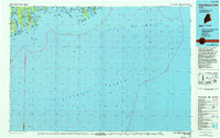
1986 Map of Petit Manan Point
USGS Topo · Published 1994About this map
Petit Manan Point juts into the Gulf of Maine, defining a coastline of deep bays and dozens of rocky islands along the Hancock and Washington County line. This 1980s survey illustrates a seafaring landscape where small coastal settlements like Corea and Prospect Harbor are sheltered by geographic features such as Bois Bubert Island and Dyer Island. The map meticulously details the intricate shoreline from Gouldsboro Bay to Jonesport, showing the relationship between land and the Atlantic Ocean.
Find a feature on this map
98 named features on this map. Tap any name to fly to it.
Don’t see what you’re looking for? This feature index may not catch every label — zoom into the map to look around manually.
Map Details
Editions of this 1986 Petit Manan Point Map
2 editions found
Other maps of this area

1902 · Cherryfield
USGS Topo · 1:62,500

1904 · Cherryfield
USGS Topo · 1:62,500

1904 · Bar Harbor
USGS Topo · 1:62,500

1904 · Petit Manan
USGS Topo · 1:62,500

1917 · Cutler
USGS Topo · 1:62,500

1918 · Machias
USGS Topo · 1:62,500

1918 · Cutler
USGS Topo · 1:62,500

1921 · Great Wass Island
USGS Topo · 1:62,500

1921 · Columbia Falls
USGS Topo · 1:62,500

1930 · Tunk Lake
USGS Topo · 1:48,000