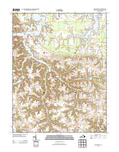
2013 Map of Machodoc
USGS Topo · Published 2013About this map
Mcguires Wharf and Beales Wharf stand as reminders of the maritime commerce that long defined the Westmoreland County shoreline along Nomini Creek. The landscape is a network of deep-water coves and points, where settlements like Hinnom, Nomini, and Mount Holly are connected by the historic Cople Highway. Further inland, the map reveals a traditional rural structure centered on millponds and crossroads, such as Beales Millpond near Kremlin and the southern cluster of Acorn and Oldhams. This 2013 survey illustrates the endurance of family-named landholdings like Antioch Farm and Mount Pleasant Farm, alongside specialized landmarks such as the Westmoreland Lookout Tower and Whitehall Farm Airport. The numerous runs and branches, including Newtons Mill Run and Tavern Run, underscore the historical reliance on local water sources for both industry and navigation in this Chesapeake Bay tributary region.
Find a feature on this map
143 named features on this map. Tap any name to fly to it.
Don’t see what you’re looking for? This feature index may not catch every label — zoom into the map to look around manually.
Map Details
Editions of this 2013 Machodoc Map
This is the sole edition of this map. No revisions or reprints were ever made.
Other maps of this area

1892 · Piney Point
USGS Topo · 1:62,500

1892 · Montross
USGS Topo · 1:62,500

1894 · Piney Point
USGS Topo · 1:62,500

1895 · Nomini
USGS Topo · 1:125,000

1895 · Piney Point
USGS Topo · 1:62,500

1895 · Montross
USGS Topo · 1:62,500

1898 · Nomini
USGS Topo · 1:125,000

1901 · Piney Point
USGS Topo · 1:62,500

1917 · Morattico
USGS Topo · 1:62,500

1918 · Tappahannock
USGS Topo · 1:62,500