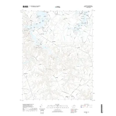
2019 Map of Machodoc
USGS Topo · Published 2019About this map
Nomini Creek and Lower Machodoc Creek carve a labyrinth of coves and necks through this portion of Westmoreland County, defining a landscape of tidal fingers and historic landings. The waterway is punctuated by numerous family-named points such as Kirk Point, Hanley Point, and Boyse Point, reflecting a long history of maritime settlement and private riparian access. At the head of the marshes, established communities like Hague, Mount Holly, and Nomini serve as hubs for the surrounding farm and timber lands.
Find a feature on this map
154 named features on this map. Tap any name to fly to it.
Don’t see what you’re looking for? This feature index may not catch every label — zoom into the map to look around manually.
Map Details
Editions of this 2019 Machodoc Map
This is the sole edition of this map. No revisions or reprints were ever made.
Other maps of this area

1892 · Piney Point
USGS Topo · 1:62,500

1892 · Montross
USGS Topo · 1:62,500

1894 · Piney Point
USGS Topo · 1:62,500

1895 · Nomini
USGS Topo · 1:125,000

1895 · Piney Point
USGS Topo · 1:62,500

1895 · Montross
USGS Topo · 1:62,500

1898 · Nomini
USGS Topo · 1:125,000

1901 · Piney Point
USGS Topo · 1:62,500

1917 · Morattico
USGS Topo · 1:62,500

1918 · Tappahannock
USGS Topo · 1:62,500