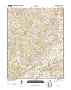
2013 Map of Madison Mills
USGS Topo · Published 2013About this map
The Rapidan River and its northern tributaries define this agricultural landscape in central Virginia. A network of rural crossroads and historic milling sites, including Madison Mills and Twymans Mill, anchors the community's settlement pattern. The terrain is marked by the distinct elevation of Lost Mountain and the winding courses of Beautiful Run and Beaverdam Run. To the north, the Robinson River forms a natural boundary near Locust Dale, while small settlements like Radiant, Oakpark, and Aroda are connected by secondary roads such as Elly Rd and Twymans Mill Rd. This digital survey shows the area's continued reliance on its historical watercourses and the preservation of long-standing place names like Burnt Tree and Achash, providing a clear record of the region's rural character and property layout in the early 21st century.
Find a feature on this map
92 named features on this map. Tap any name to fly to it.
Don’t see what you’re looking for? This feature index may not catch every label — zoom into the map to look around manually.
Map Details
Editions of this 2013 Madison Mills Map
This is the sole edition of this map. No revisions or reprints were ever made.
Other maps of this area

1892 · Gordonsville
USGS Topo · 1:125,000

1930 · Madison
USGS Topo · 1:48,000

1933 · Madison
USGS Topo · 1:62,500

1935 · Charlottesville
USGS Topo · 1:62,500

1939 · Charlottesville
USGS Topo · 1:62,500

1949 · Charlottesville
USGS Topo · 1:250,000

1949 · Charlottesville
USGS Topo · 1:62,500

1956 · Charlottesville
USGS Topo · 1:250,000

1961 · Gordonsville
USGS Topo · 1:62,500

1961 · Rapidan
USGS Topo · 1:62,500