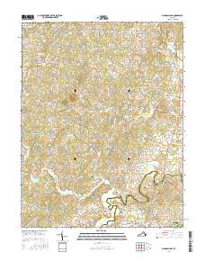
2016 Map of Madison Mills
USGS Topo · Published 2016About this map
The Rapidan River and Robinson River serve as the defining natural boundaries of this Central Virginia landscape, tracing the border between Madison Co and Orange Co. In this contemporary survey, the rural character is anchored by historic crossroads and mill sites such as Madison Mills and Twymans Mill, reflecting a long-standing agricultural and river-based economy. To the west, Lost Mtn rises above the rolling terrain, while numerous small waterways including Beautiful Run and Dark Run drain into the primary river basins. Small communities and named junctions like Oakpark, Elly, and Five Forks are linked by a network of local roads including Lillards Ford Rd and Old Forge Way, indicating the persistence of historic travel routes. For the local researcher, the map documents specific landmarks like Kemper Cem and the distinctive geological features of the Culpeper Basin south of Tanners.
Find a feature on this map
97 named features on this map. Tap any name to fly to it.
Don’t see what you’re looking for? This feature index may not catch every label — zoom into the map to look around manually.
Map Details
Editions of this 2016 Madison Mills Map
This is the sole edition of this map. No revisions or reprints were ever made.
Other maps of this area

1892 · Gordonsville
USGS Topo · 1:125,000

1930 · Madison
USGS Topo · 1:48,000

1933 · Madison
USGS Topo · 1:62,500

1935 · Charlottesville
USGS Topo · 1:62,500

1939 · Charlottesville
USGS Topo · 1:62,500

1949 · Charlottesville
USGS Topo · 1:250,000

1949 · Charlottesville
USGS Topo · 1:62,500

1956 · Charlottesville
USGS Topo · 1:250,000

1961 · Gordonsville
USGS Topo · 1:62,500

1961 · Rapidan
USGS Topo · 1:62,500