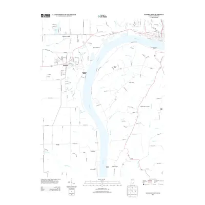
2013 Map of Madison West
USGS Topo · Published 2013About this map
Hanover stands prominently on the bluffs overlooking the Ohio River, a landscape defined by sharp elevation changes and the numerous waterfalls that carve through the limestone terrain. The area is marked by a series of dramatic drops, including Deadman Falls, Horseshoe Falls, and Chain Mill Falls, illustrating the erosive power of the tributaries as they descend toward the river valley. The agricultural and transport history of the region is evident in the presence of Antioch Grange and the Lee Bottom Airport, the latter situated on the wide alluvial plain of Lee Bottom. A distinct series of ridges, such as Liberty Ridge and Pleasant Retreat Ridge, separate the drainage basins of Cooper Cr and Spring Cr, while the river itself remains the dominant geographic feature, curving past the narrow ridge known as Devils Backbone.
Find a feature on this map
163 named features on this map. Tap any name to fly to it.
Don’t see what you’re looking for? This feature index may not catch every label — zoom into the map to look around manually.
Map Details
Editions of this 2013 Madison West Map
This is the sole edition of this map. No revisions or reprints were ever made.
Other maps of this area

1939 · Bethlehem
USGS Topo · 1:24,000

1939 · Madison West
USGS Topo · 1:24,000

1948 · Bethlehem
USGS Topo · 1:24,000

1948 · Madison West
USGS Topo · 1:24,000

1953 · Madison West
USGS Topo · 1:24,000

1953 · Bedford
USGS Topo · 1:24,000

1953 · Madison East
USGS Topo · 1:24,000

1953 · Bethlehem
USGS Topo · 1:24,000

1956 · Volga
USGS Topo · 1:24,000

1956 · Kent
USGS Topo · 1:24,000