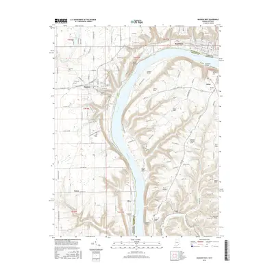
2016 Map of Madison West
USGS Topo · Published 2016About this map
The Ohio River carves a deep, winding valley through this borderland between Indiana and Kentucky, defining the geography of Madison and its southern neighbor, Milton. Along the high bluffs of the western bank, the campus of Hanover Coll overlooks the river, situated near the town of Hanover. The landscape is characterized by sharp relief, where numerous creeks like Clifty Cr and Ramsey Cr have etched deep ravines into the limestone, creating dramatic features such as Devils Backbone and several waterfalls, including Horseshoe Falls and Butler Falls.
Find a feature on this map
153 named features on this map. Tap any name to fly to it.
Don’t see what you’re looking for? This feature index may not catch every label — zoom into the map to look around manually.
Map Details
Editions of this 2016 Madison West Map
This is the sole edition of this map. No revisions or reprints were ever made.
Other maps of this area

1939 · Bethlehem
USGS Topo · 1:24,000

1939 · Madison West
USGS Topo · 1:24,000

1948 · Bethlehem
USGS Topo · 1:24,000

1948 · Madison West
USGS Topo · 1:24,000

1953 · Madison West
USGS Topo · 1:24,000

1953 · Bedford
USGS Topo · 1:24,000

1953 · Madison East
USGS Topo · 1:24,000

1953 · Bethlehem
USGS Topo · 1:24,000

1956 · Volga
USGS Topo · 1:24,000

1956 · Kent
USGS Topo · 1:24,000