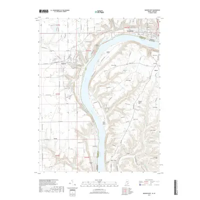
2019 Map of Madison West
USGS Topo · Published 2019About this map
The Ohio River carves a deep valley between Indiana and Kentucky, anchoring the historic riverside communities of Madison and Hanover. On the northern bank, the city of Madison sits at the base of steep bluffs near Springdale Cem, while the town of Hanover overlooks the river from a higher plateau. The dramatic topography is defined by features like Devils Backbone and Coopers Bottom, illustrating the sharp elevation changes that dictated early settlement patterns.
Find a feature on this map
86 named features on this map. Tap any name to fly to it.
Don’t see what you’re looking for? This feature index may not catch every label — zoom into the map to look around manually.
Map Details
Editions of this 2019 Madison West Map
This is the sole edition of this map. No revisions or reprints were ever made.
Other maps of this area

1939 · Bethlehem
USGS Topo · 1:24,000

1939 · Madison West
USGS Topo · 1:24,000

1948 · Bethlehem
USGS Topo · 1:24,000

1948 · Madison West
USGS Topo · 1:24,000

1953 · Madison West
USGS Topo · 1:24,000

1953 · Bedford
USGS Topo · 1:24,000

1953 · Madison East
USGS Topo · 1:24,000

1953 · Bethlehem
USGS Topo · 1:24,000

1956 · Volga
USGS Topo · 1:24,000

1956 · Kent
USGS Topo · 1:24,000